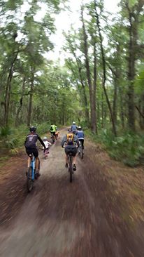
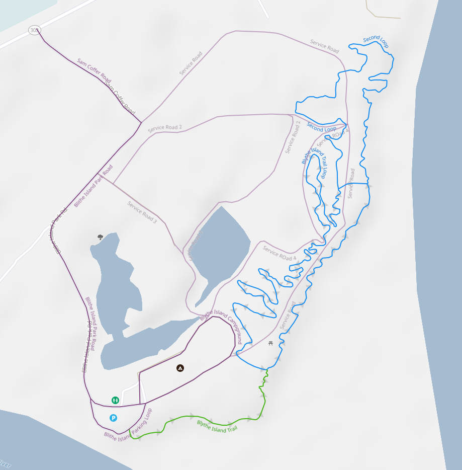
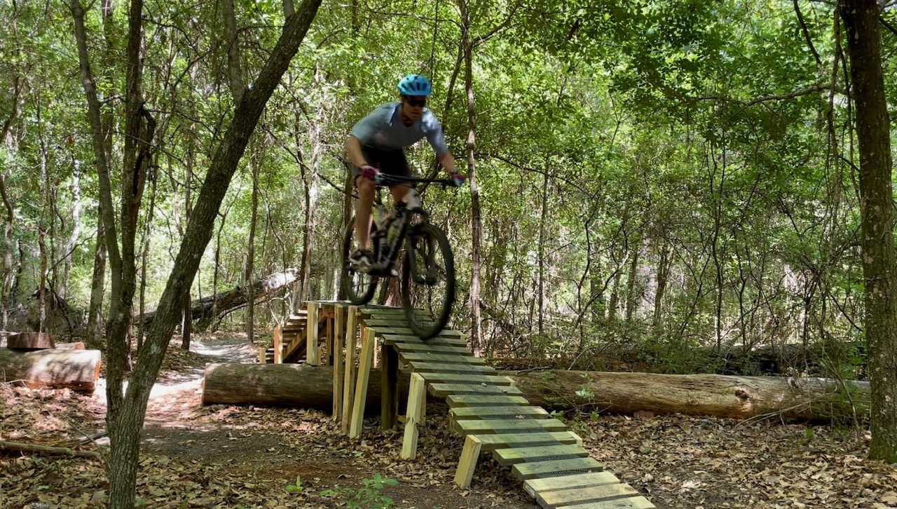
Located in Glynn county, only a stone's throw away from I-95, in Blythe Island Recreational Park. This trail features more than 4 miles of trails. And more will be added in the near future.
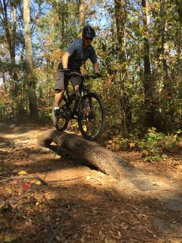
The trail consists of mostly single track with some wood features for the adventurous.
Located just south of the Georgia Southern University Armstrong Campus this trail is currently in active delopment. About 4 miles of rideable exist at the time of writing. More to come! Of all the trails in the Savannah Low Country, this trail has the most topography.
In the near future a jump line will be added for some extra fun! And don't worry if you botch the landing. St. Joseph's Hospital is only 5 minutes away!
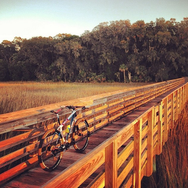
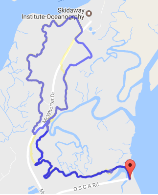
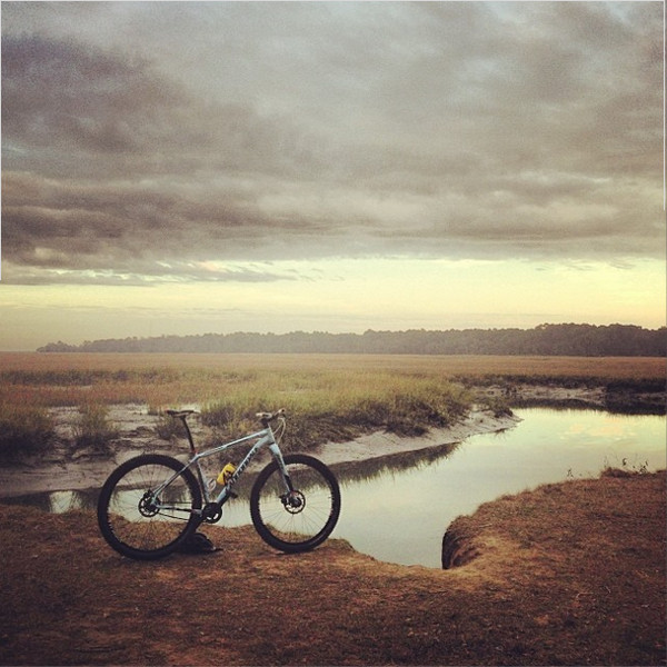
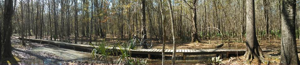
Located on scenic Skidaway Island this trail is situated between Bull River, Skidaway River and Grimball Creek. Along the trail you will find some stunning views of the Savannah Wetlands.
The trail begins at the Priest Landing trailhead and the end of OSCA road. The bluffside of the trail features seven miles of flowing single track with some bridges and log piles along the way. It features an alternate and somewhat technical route directly along the bluff.
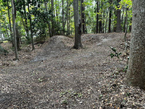
The marsh side (across McWhorter Rd. near Marine Science Center) of the trail features five foot dirt piles and more great low country views. Slightly more technical than Whitemarsh Preserve, and still a great family friendly trail.
Local Trails
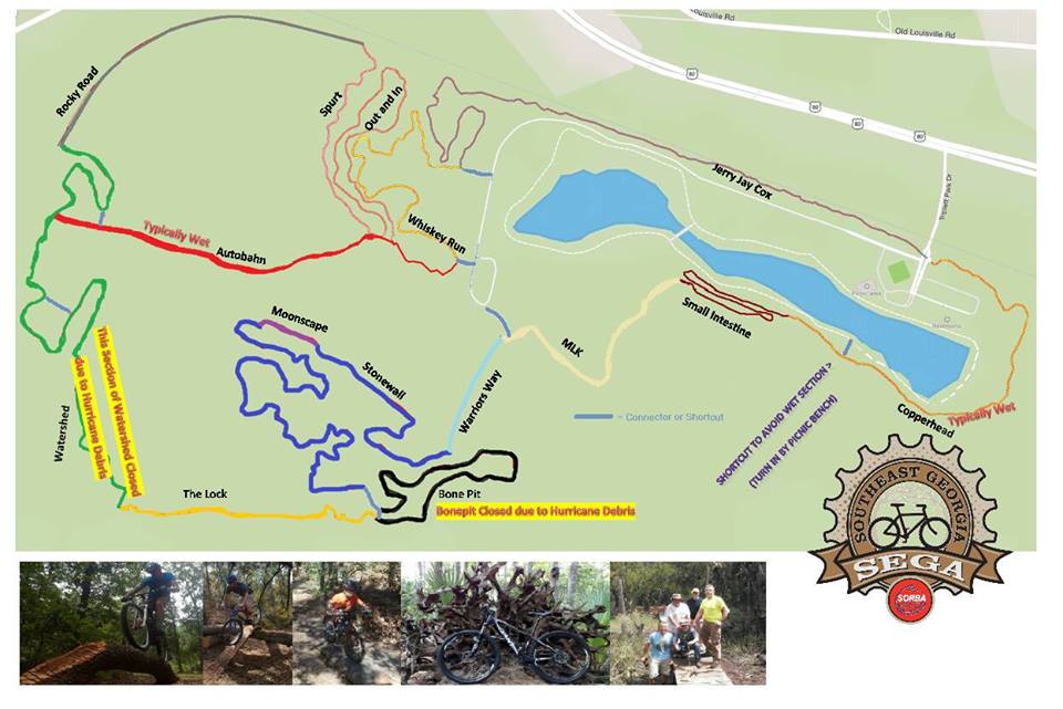
Tom Triplett Park is a community park operated by the Chatham County Parks & Recreation Department. It is a family friendly park located off of Highway 80, between Dean Forest Road and I-95. Some amenities include:
- 1.5 mi Jogging Trail
- Two Tennis Courts
- Disk Golf Course
- Restrooms
The mountain bike trail is 7.5 miles of semi-technical and rooty single track with about 3 foot of elevation change. The tight and twisty nature of the trail still makes it a fun ride and good work out. Depending on the weather, trail conditions vary between dry and extremely wet. Tom Triplett is the most technical of the three low country trails.
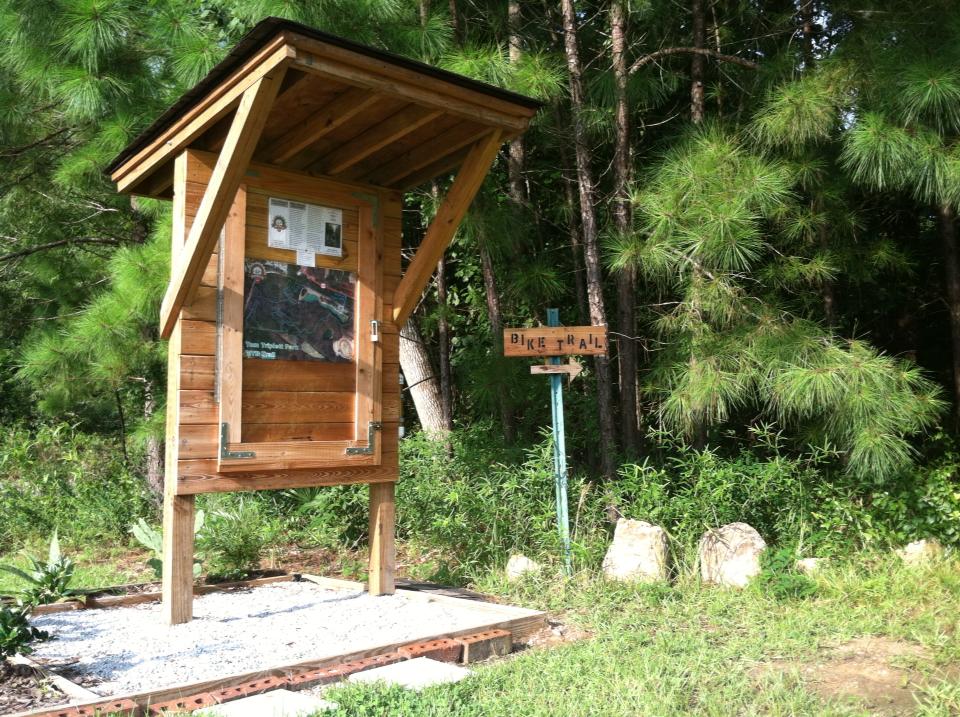
Although not strictly directional, the trail is marked clock-wise. A kiosk with a trail map and some general information about SEGA-SORBA marks the trailhead. When entering the park you will find it on the left, just past the railroad track. If the full loop is completed, the trail exits on the opposite side of the road.
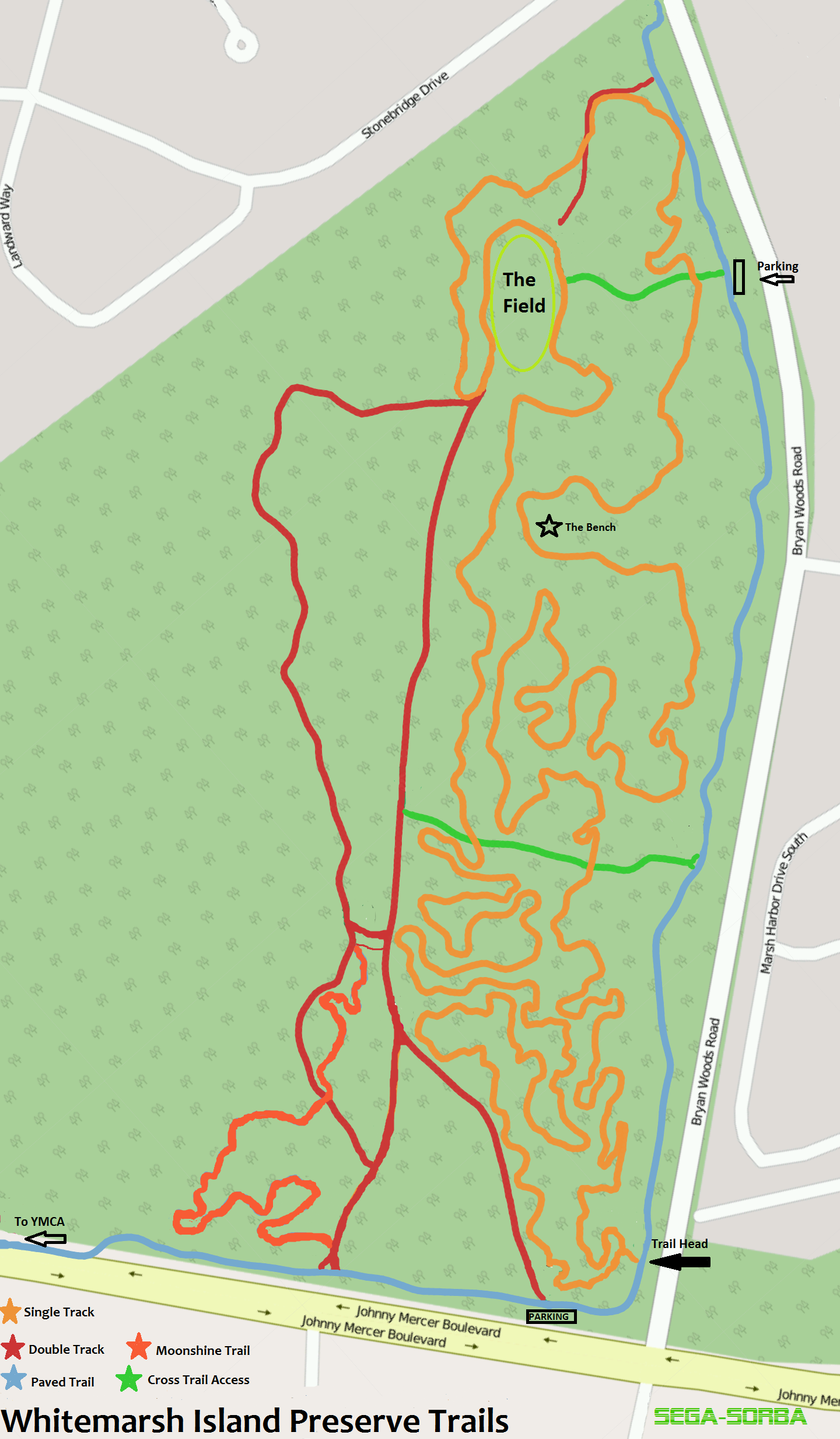
Located about 10 miles east of beautiful Savannah, Georgia, on Whitemarsh Island, these 6+ miles of family friendly off-road trails wind through a picturesque backdrop of historic live oaks, Spanish moss, and marshes.
The "Inner Loop" is a winding single track well packed and built for speed. From tight snake-like turns on "Twister" to the fast flow of Fontana "Speedway". There are several log jam crossings and dips for the more advanced and go-arounds for the less experienced. Truly a fun trail for riders of all experience levels. A local favorite for Cycle-cross training and MTB speedsters.
Bordering the preserve, along Johnny Mercer Blvd and Bryan Woods Rd, is a paved walking/ jogging trail that begins at the YMCA next door ends near Hwy 80.
The marsh side of the preserve is bordered by a double track trail (Happy Trail) starting at the paved trail on Johnny Mercer and ending in a huge open field on the north end of the property. Quite popular with dog walkers, hikers, and casual bikers.